Exploring Arizona’s Snowpack–Streamflow Connection with the Arizona Water Observatory
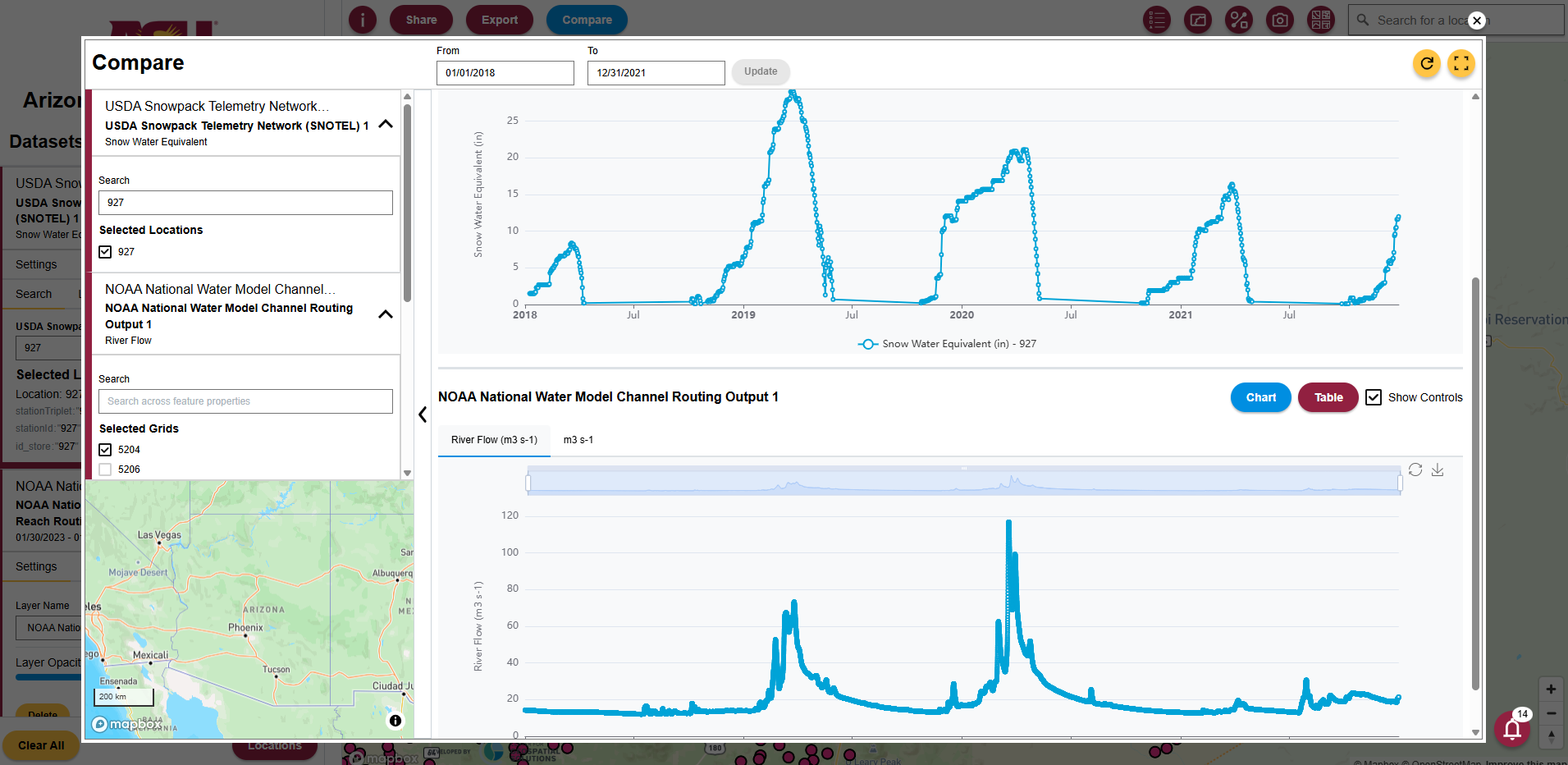
In this tutorial, we demonstrate how the Arizona Water Observatory (AWO) can be used to follow the movement of water through a watershed in Arizona. We begin with snowpack observations from a SNOTEL station in the San Francisco Peaks, then identify the watershed that receives the snowmelt. Next, we retrieve watershed-averaged soil moisture data from NASAʼs Soil Moisture Active Passive (SMAP) mission and streamflow at the watershed outlet, where it flows into the Little Colorado River, using data from the National Water Model. Together, these datasets illustrate how water moves through the landscape from mountain snowpack to downstream streamflow.
- Check out the quick start blog at: https://cgs-earth.github.io/ArizonaWaterObservatory/posts/snowpack-streamflow-connection/