snow
WRR Publication
A new publication in the journal Water Resources Research (Ghimire et al., 2026) examined the roles of fall soil moisture and spring weather on modulating snow-streamflow dynamics in the Colorado River Basin using the Variable Infiltration Capacity model. These findings indicate that in the Upper Basin, soil moisture can help predict how much water will…
ASU-SRP snow surveys show much of Arizona’s headwater snowpack melted in weeks
Repeat airborne snow surveys over the Upper Black River found that due to a dry and warm winter, most of the snow water measured in January and February had melted by mid-March, offering water managers a view of how quickly the season changed. The first flight in January measured about 9.1 thousand acre-feet (TAF) of snow…

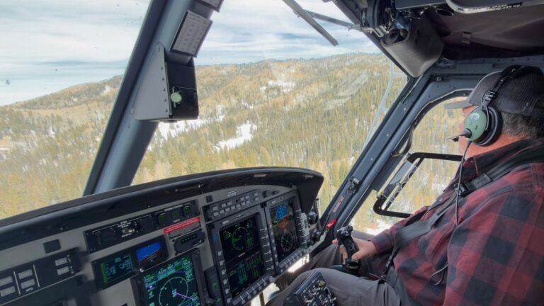
ASU, SRP project takes flight to improve water supply forecasting
Arizona State University and Salt River Project are working with Airborne Snow Observatories Inc. on an innovative project to measure snowpack in the Salt River watershed — providing crucial data to improve water management. For the first time, a collaborative research team is using an airplane equipped with state-of-the-art scanning lidar and imaging spectrometers, along…
Geophysical Research Letters Publication
A new publication in Geophysical Research Letters (Wang et al. 2025) describes the use of high-resolution Planet imagery for mapping snow cover and determining the terrain and vegetation controls at unprecedented scales achieving new insights for the Salt and Verde River basins. Congratulations to the authors associated with the Center for Hydrologic Innovations!

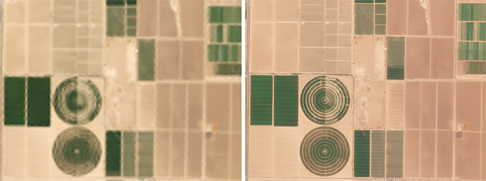
New methods for detecting snow in Arizona for water supply
Congratulations to the team from the Center for Hydrologic Innovations that was recently featured by the Arizona Water Innovation Initiative! Postdoctoral scholar Zhaocheng Wang described the effort as: “Planet imagery is useful for the type of dryland hydrology we have in Arizona. We trained a machine learning model called a convolutional neural network that can…
WRR Publication
A new publication in Water Resources Research (Wang et al., 2024) explores the sensitivity of the precipitation partitioning method on the future projects of snowpack conditions and streamflow in the Colorado River basin, with implications for other modeling activities in cold season dominated watersheds. Congratulations to authors associated with the Center for Hydrologic Innovations!
Center efforts with Planet featured in Arizona Water Innovation Initiative
The Arizona Water Innovation Initiative (AWII) featured our efforts with the satellite imaging company Planet with respect to water supply and demand estimates in Arizona. See blog at the link below